Global shipping
sometimes these maps are so pro-capital its embarrassing. This one is of course, but its also informative. Here are the paths of need and greed, crime and time…
By Sheehan Moore, CUNY § Ten miles south of New Orleans, on the West Bank of the Mississippi, the trees flanking both sides of Highway 3134 stop abruptly. A…
In the Digital Age, maps are closer to us than ever before—a quick tap on a smartphone and you’re off to the nearest Starbucks for a quick coffee…
How the conceptual heritage of the new and old world pervades today’s racial economy of genetics. On a former occasion I wrote to you at some length…
One of the most important moments in the development of cartography occurred when an obscure doctor, John Snow, produced his so-called ghost map of the cholera outbreak in…
Where do we draw the line of separation? Who draws it, and for which purposes? When the former interior minister of Italy, Matteo Salvini, launched his little war…
As neo-nationalists gain strength across Europe and the promise of ‘strong’ borders continues to gain traction with electorates across the world, we need few reminders of the paradoxes…
In Mapping Society: The Spatial Dimensions of Social Cartography – available to download here for free – Laura Vaughan offers an analysis of how maps have both described and shaped social…
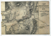
Fort Yamhill, on the Grand Ronde Indian Reservation, was established in March 1856. A detachment of troops, dragoons -mounted infantry- were assigned to the fort to keep the…
All this Salmon river research has led me to the Oregon State Archives. There they have the records of the Oregon State Highway Commission. Commission records go back…