Oregon Native Place Names in the U.S. Coast and Geodetic Survey, Part 1
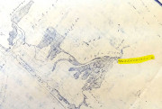
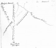
In the map collections of Oregon Historical Society there is a selection of Coast Survey maps. Most of these maps date from 1874 and there are some later.…
In the map collections of Oregon Historical Society there is a selection of Coast Survey maps. Most of these maps date from 1874 and there are some later.…
I encountered this history, partially unpublished I believe, in the Oregon Historical Society Library. The published book of his journal focuses on the second trip down the coast…
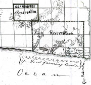
In the 1860’s, the Indians of the Grand Ronde Indian Reservation needed a route to get to the coast to gather fish. The Indian agents Continue reading
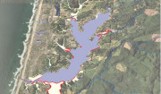
Devil’s Lake is in Lincoln City, in fact it is the only such lake and state park completely contained within a city in Oregon. The Continue reading
In 1875, the United States Congress passed an act, March 3, 1875, to reduce the Coast Reservation. This act, terminated the Alsea Reservation, that section Continue reading
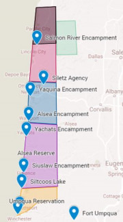
The story of the Coast Reservation of Oregon is complicated. The Coast Reservation is created in 1855 by Presidential Executive Order and then for some Continue reading